


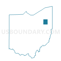
CHARLESTOWN B Voting District, Portage County, Ohio
About
Outline

Summary
| Unique Area Identifier | 651069 |
| Name | CHARLESTOWN B Voting District |
| County | Portage County |
| State | Ohio |
| Area (square miles) | 1.14 |
| Land Area (square miles) | 1.14 |
| Water Area (square miles) | 0.00 |
| % of Land Area | 99.70 |
| % of Water Area | 0.30 |
| Latitude of the Internal Point | 41.15836160 |
| Longtitude of the Internal Point | -81.15984980 |
Maps


Graphs
Select a template below for downloading or customizing gragh for CHARLESTOWN B Voting District, Portage County, Ohio


